Map of a Nation (22 page)
Authors: Rachel Hewitt

S
HOFTLY BEFORE THE
Ordnance Survey’s foundation in 1791, Joseph Banks had presented the Royal Society’s prestigious Copley Medal to Major James Rennell, who had made an accurate map of Bengal, based on a trigonometrical survey. Banks’s presentation speech was bittersweet: ‘I should rejoice could I say that Britons, fond as they are of being considered by
surrounding
nations as taking the lead in scientific improvements, could boast a general map of their island as well executed as Major Rennell’s delineation of Bengal and Bahar: a tract of country considerably larger in extent than the whole of Great Britain and Ireland.’ Banks concluded with a final dig at the achievements of British map-makers: ‘The accuracy of [Rennell’s]
particular
surveys stands yet unrivalled by the most laborious performance of the best county maps that this nation has hitherto been able to produce.’ As Banks indicated, the Ordnance Survey’s arrival in 1791 was long overdue.
But it is reasonable to wonder why it came into being at that precise moment, when William Roy had spent over forty years failing to achieve the same.
The answer partly lies in events that began over the English Channel in the summer of 1789. In France, long-simmering resentment at the absolutist power of the monarchy combined with anger at the Catholic Church’s
disproportionate
privilege. Humiliating military defeat during the Seven Years War was followed by serious national debts accrued during the American War of Independence. A sweltering summer, a failed harvest and financial and ministerial collapse united to spark a revolution. On 14 July 1789 a crowd stormed the Bastille prison. This mob was joined by soldiers and the uprising acquired an armed militia. The old administration retreated and in its place a National Assembly emerged, rewriting France’s constitution and removing power from the monarchy.
At first, the French Revolution drew a mixed response in Britain. British Whigs were generally rather bullish. Celebrations had been held the
previous
year to mark the centenary of the 1688 Glorious Revolution, and 101 years later there was widespread support in England for the French Revolution as a long-due equivalent. Both events were thought to embody enlightened principles of government, based on mankind’s inalienable rights rather than the power of an arbitrary monarch. Addressing the Society for the Commemoration of the Revolution in Great Britain in November 1789, the Nonconformist minister Richard Price celebrated the event in
impassioned
tones:
I have lived to see a diffusion of knowledge, which has undermined superstition and error – I have lived to see the rights of men better understood than ever; and nations panting for liberty, which seem to have lost the idea of it. I have lived to see 30 MILLIONS of people,
indignant
and resolute, spurning at slavery, and demanding liberty with an irresistible voice; their king led in triumph, and an arbitrary monarch surrendering himself to his subjects.
He offered an eloquent warning to proponents of despotic government: ‘Tremble all ye oppressors of the world! … You cannot hold the world in darkness. Struggle no longer against increasing light and liberality. Restore
to mankind their rights; and consent to the correction of abuses, before they and you are destroyed together.’
The French Revolution had important implications for cartography on both sides of the Channel. The French had begun a national triangulation over a century before the Ordnance Survey, and their scientists and military officers boasted a far more sophisticated acquaintance with maps than their contemporaries in Britain. Over the course of the eighteenth century the French army had become large, mobile and extremely skilled in battle manoeuvres and movements, which were often based on its officers’
innovative
use of maps. It has been said that it was ‘the French who had made the greatest strides in the application of cartography to the logistics of an army on the march and who, in any case, had now assumed the mantle of European leadership in the realm of scientific map-making’.
These military and geodetic manifestations of cartography were
underpinned
by a firm philosophical basis. French
philosophes
had embraced maps as embodiments of the ‘esprit géométrique’ of the Enlightenment and, as a language of reason, cartography seemed a perfect way to communicate the Revolution’s emphasis on
liberté
,
égalité
, and
fraternité
. And so from 1789 onwards the revolutionary Assembly set about reorganising France’s
administrative
boundaries. The provinces of
ancien régime
France were dissolved and in their place a more ‘rational’ structure was proposed, with the intention of weakening local loyalties and homogenising regional idiosyncrasies into a single national identity. The Assembly segmented France into ever smaller subdivisions:
régions, départements
, cantons and communes. In numerous cases, the
départements
were named after communal geographical attributes, such as mountains and waterways, to which every citizen enjoyed the same access. The plan of this new ‘rational’ France looked like a cartographer’s dream: a reorganisation of the French nation according to equal geometric units. And this redrawing of France’s internal boundaries was entirely reliant upon the work of map-makers, especially on charts produced by Robert de Hesseln and Philippe Hennequin, and the
Carte de Cassini
. Back in Britain, the conservative Whig politician and polemicist Edmund Burke condemned this rational restructuring of France as the malady of ‘a geometrical and arithmetical constitution’. He dismissed the Revolution and its consequences
as the products of a nonsensically map-minded set of politicians. ‘Nothing more than an accurate land surveyor, with his chain, sight, and theodolite, is requisite for such a plan as this,’ he wrote.
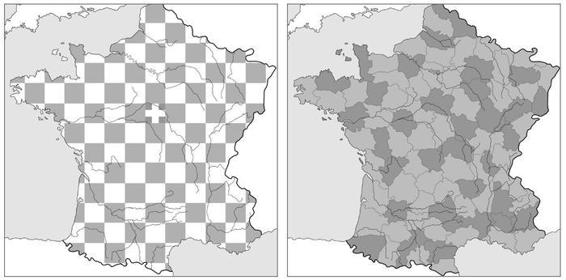
19. Outline for administrative reorganisation of France following the French Revolution.
In the following years, the Revolution continued to concern itself with measurements. In 1790 the National Assembly and King Louis XVI, who was a great enthusiast for cartography, both authorised the Académie des Sciences to design a new system of weights and measures. It has been estimated that prior to this project, ‘
ancien régime
France contained a staggering 250,000
different
units of weights and measures’. The revolutionaries wanted to instigate national homogeneity by coming up with a universal standard measurement. This would not be based on arbitrary authority like the ‘foot’ unit, which was said to be based on the length of King Henry I’s twelve-inch foot, but on reason and the earth itself, on which all citizens could stake a claim. This unit of measurement would be ‘for all men, for all time’. The resulting idea of the ‘metre’ unit was intended to measure one ten-millionth of the distance from the North Pole to the equator. To extrapolate this length, the geodesists Jean Baptiste Joseph Delambre and Pierre François André Méchain (the latter of whom had worked alongside Jean Dominique Cassini and William Roy during the Paris–Greenwich triangulation) extended the Cassinis’ Paris Meridian down to Barcelona in Spain. The arc now spanned the distance
between Dunkirk and Barcelona and represented one-tenth of the distance between the equator and North Pole. By dividing the resulting measurement by one million, the value of the metre unit was found.
Méchain and Delambre had been members of the Académie Royale des Sciences. After the Revolution, this organisation was reconstituted as the Académie des Sciences, part of the Institut de France. Previously the concern of a royal institution, surveying was now working on behalf of the Revolution and its love of reason. As we can see, politics and space had become deeply intertwined in this period. The redrawing of France’s boundaries and the measurement of the metre show how space became politicised, and at the same time politics were spatialised: that is to say, political concepts were described in a language of space. Our well-worn terminology of right-and left-wing political principles derives from the positioning of conservatives and radicals on the right and left sides of the president in Assembly debates in France from 1789. And this use of space to describe a political world was also evident in more metaphorical ways, in Britain as well as in France.
Since the English Civil War, British satirists had used images of
upside-down
worlds as ‘emblems of these distracted times’. A 1642 print called
Mad Fashions, Odd Fashions, All Out of Fashion
showed how ‘A horse erect upon his hind-legs drives the cart, a church is inverted, fish sail in the atmosphere, a candle burns with the flame downwards, a labourer is wheeled by his own barrow, and several timid animals chase the more ferocious.’ The artist had designed this ‘topsy-turvy’ world as a metaphor for a nation whose king had been ousted by a commoner during the Civil War. After the French Revolution, similar images proliferated as depictions of the republican
climate
across the Channel. The politician and man of letters Horace Walpole wrote of ‘that topsy-turvy-hood which characterizes the present age’, and the novelist Fanny Burney described a radical character as ‘an adept in turning the world upside down’. A children’s book called
Signor Topsy-Turvy’s Wonderful
Magic Lantern; or, the World Turned Upside Down
was a thinly veiled attack on a world in which ‘the servants [had] turned masters’ and ‘the fish [had] turned fishers’; it ended with the conservative ‘simple moral’ that ‘whate’er thy
station
, be content’. In this atmosphere, when the politics of space was so topical, the act of mapping possessed particular resonance.

T
HE NATURE OF
the French Revolution changed dramatically in the years after its eruption in 1789. On 13 August 1792 King Louis XVI and his wife Marie Antoinette were arrested. Five weeks later a new constitutional and legislative assembly declared France a republic and abolished the
monarchy
. In mid December charges of high treason and crimes against the state were levelled at Louis XVI. Although not all the Assembly was in favour of the death penalty, the motion was carried nonetheless. On 21 January 1793 in the Place de la Concorde, the King was executed by guillotine.
As the spring progressed, Paris was engulfed by increasing violence as rival revolutionaries clashed. Initially a minority, the Jacobins soon gathered strength. Fuelled by the Paris mob and led by Maximilien Robespierre, this faction took over the Assembly and established a revolutionary
dictatorship
. The newly founded Committee of Public Safety fell under their control. Through this Committee, which was designed to suppress
counter-revolutionary
activity, and along with the Revolutionary Tribunal, the Jacobins instigated a policy of execution of anyone accused of ‘crimes against liberty’. Suspects included royalists, aristocrats, the Catholic clergy, members of the middle class and thousands of workers accused of draft-dodging and desertion. Between 16,000 and 40,000 people lost their heads to ‘la veuve’, the widow (or, more aptly, widow-maker): the guillotine.
In the midst of this bloody ‘Reign of Terror’, European war broke out. At the very beginning of the Revolution, only a few voices had predicted a
martial
outcome. But by 1791 various Continental monarchies were debating whether to intervene in France’s political upheavals. In the summer of 1792, the French Revolutionary Army declared war on the rulers of Austria and Prussia. Superficially this conflict was driven by ideology, but there were practical considerations too, involving territorial disputes. And it was
primarily
for such pragmatic reasons as the need to protect the nation’s overseas trading networks that Britain also drifted into the conflict in February 1793.