Authors: Codex Regius
Middle-earth seen by the barbarians: The complete collection including a previously unpublished essay (26 page)

THIN
The suffix -
thin
is believed by most interpreters to be a cognate of Sindarin
thin
“grey”. John Rateliff, in
HH
1,
bases this assumption on mere speculation: ‘
I have not found a gloss of “Thingol” from this early period, but there is no reason to doubt that it would have been the same as the later Sindarin translation: “grey-cloak”, with thin = grey.
’
Well, the gloss that Mr Rateliff was missing is in fact present in
NW
, and it does not read ‘grey’:
‘
thing
, prince;
thingol
[=]
Singoldo
.’
It seems pretty obvious to me that
Bladorthin
is a contraction of
Blador + thing
, i. e. ‘*World-prince’, ‘Prince of the World’. This is a boasting name for a great king but certainly not one unheard of. At least it is much better than that assumption by a German critic who asserted that changing the wizard’s name from Bladorthin to Gandalf had been a first step of advancing
H
to the more serious mood of
LR
. After all,
Bladder-thin
was not really a suitable name for an
Istar
, was it?
A letter published in
L
contains this remarkable passage:
‘
If Hobbiton and Rivendell are taken (as intended) to be at about the latitude of Oxford, then Minas Tirith, 600 miles south, is at about the latitude of Florence. The Mouths of Anduin and the ancient city of Pelargir are at about the latitude of ancient Troy
.’
(
L
294)
To be honest, this statement sounds a bit unlikely. A modern atlas will quickly show that it was extremely vague, to say the least. The latitudes of Florence and Troy are twice as much apart as those of Minas Tirith and Pelargir (verifying the scale of the large
LR
foldout map against the one reproduced in
TR
). However, once we accept the latitude of Hobbiton, a meridional grid may be applied to the Middle-Earth map so that it may be projected on a globe (a feat that Karen Fonstad thought impossible, cf.
TAM
E
). The results of this projection are shown in
Fig. 25
et seq.
The following discussion is based on the original
LR
maps, printed before the publication of
UT
.
Appendix B: Latitudes and longitudes of Middle-earth
To apply latitudes and longitudes, we have to know what kind of cartographic projection the
LR
map is based on. Unfortunately, the published map shows both a scale and a compass rose. And you cannot have both of them on a map unless you assume that you are depicting Arda Flat of the Second Age. Projecting a round earth always demands that either your scale or your directions are distorted!
Fortunately, the addition of the compass rose turns out to be a fault made only in the published version. Tolkien’s original hand-drawn maps in
RS
and
TR
show a scale but not a compass rose. Instead, a rectangular grid is superimposed on both maps. Each square has a vertical
and
horizontal side length of 100 miles (hence, on the originally published
LR
map, each square measures exactly 2 cm, which is certainly not an accident).
This is a cartographic projection that permits a geometric transformation into latitudes (parallels) and longitudes (meridians). A few additional assumptions are required:
- One meridian should run due North-South, preferably in the middle of the map. Incidentally, the central line of the published
LR
map passes straight through Rivendell. That is perhaps no accident, either. - All horizontal grid lines on the
H
O
M
E
maps are running due East-West. On a globe, they would be parallels to the equator, mapped at the same scale as the central meridian. For at least one grid line, this assumption is confirmed by the statement quoted in the beginning: Both Hobbiton
and
Rivendell are found at the same latitude as well as on the same horizontal grid line. - The distance of the horizontal lines is constant. This is confirmed by
RS
: the distance from one cross of the grid to another, either horizontally or vertically, is said to be 100 miles.
This evidence allows to deduce the projection of the
H
O
M
E
maps. The latitudes are parallel to the horizontal grid lines while the longitudes converge towards the upper edge of the map sheet (towards the north pole). This means that the published
LR
map preserves distances but not areas and directions and it is the compass rose that should be deleted, not the scale: the angles are increasingly distorted towards the upper left and right corners of the sheet. Only the central meridian is in fact running due South-North; the other longitudes describe paraboloids that, hypothetically, converge with the central meridian at the poles.
The scale of the published
LR
map is 1 cm = 50 miles or 1:8 000 000. On the earth, two degrees of latitude are about 111 km apart from each other. Two adjacent meridians are separated equally far at the equator, to converge towards the poles. Hence, for a known latitude
L
, the distance
D
from one crosspoint of a meridian to the next crosspoint (in steps of one degree) can be computed as:
| |
If you want to know how many centimetres that is on the
LR
map, remember that 2 cm = 100 miles, so that 1.25 cm = 100 km. Thus, the distance
D
1
of two crosspoints, measured in cm, is:
| |
| |
For a given latitude, start at the central meridian of the
LR
map and count the crosspoints with the proper longitudes. This will be done in the following
Latitudes on the LR Map
Oxford at located at about 51°45’N. Accepting this value as the latitude of Hobbiton in accordance with
L
294
, we may now draw the proper parallels on the
LR
map. The main parallels on the
LR
map and a modern world map follow.
35°N -
The Western exit of the firth of Umbar
In Europe/North Africa: Sahara-Atlas, Crete, Cyprus
The City of the Corsairs is found at about the latitude of Tanger.
40°N -
Southern Tolfalas, the W-E range of the Ephel Duath
In Europe/Asia: Madrid (Spain), Sardinia, Gulf of Tarent, Troy
Contrary to Tolkien’s estimation, Pelargir is located at 41°10’, at the latitude of Istanbul rather than of Troy.
45°N -
Tol Brandir, Dead Marshes, Morannon
In Europe: Bordeaux (France), the plain of the river Po, Crimea
Minas Tirith is located almost exactly at 43°. But this is not the latitude of Florence, 43°50’, that would be closer to Caer Andros.
50°N -
Eregion, the East Bight, the lower W-E flow of the Carnen
In Europe: Lizard Point/Cornwall, Amiens, Mainz, Bohemia
In Beleriand, this parallel would continue via Ossiriand between Duilwen and Adurant to the sand bank in the Bay of Balar. But in the First Age, earth was flat and a different coordinate grid applied.
55°N -
Mount Gundabad, Ered Mithrin, Withered Heath
In Europe: Londonderry, Fuenen, Bornholm, Lithuania
On the
RS
map, this latitude corresponds to the uninterpreted line that bisects the squares H and I.
In Beleriand, the line would pass Lake Mithrim, Barad Eithel, Haudh-en-Ndengin.
Longitudes on the LR Map
The meridians follows. As mentioned before, the central meridian seems to cross Rivendell where the
LR
map is supposed to have originated. The ‘Greenwich’ meridian of Middle-earth could arbitrarily be applied there.
But there may be a different one that separates West and East: ‘
Its eastern frontier was roughly the River Carnen to its junction with Celduin (the River Running), and so to Núrnen, and thence south to the ancient confines of South Gondor. (It did not originally exclude Mordor …)
’
(
TI
)
In this system, the Rivendell meridian is 13°W, resulting in the following:
35°W -
The island of Himling.
30°W -
Northern Ered Luin, Harlindon, missing Harlond to the west.
25°W -
Forochel, via Hills of Evendim and the Far Downs, to the Mouths of Baranduin.
20°W -
North Downs, Midgewater Marshes, Enedwaith, Andrast.
15°W -
Ettenmoors, Eregion, Orthanc (precisely!), Anfalas.
10°W -
Missing the Carrock a little to the east, the Field of Celebrant, the tip of the Entwash delta, Harondor.
5°W -
East of the Mountains of Mirkwood, eastern edge of Udun.
0° -
Carnen, Celduin, Nurn.
5°E -
The shallows in the Sea of Rhun, passing the confines of Mordor in the East.
Projected on the map of Europe, the
LR
map covers Central Europe and the Mediterranean as expected. Its area spans 20° of latitude (55 to 35°) and, at the northern edge of the map, up to 40 ° of longitude (29°W to 10°E).
If we assume that Hobbiton is not only at the latitude but also at the longitude of Oxford, then the
LR
map overlays the geographic territory between Scotland and Crete and between Ireland and Kiev. Minas Tirith and Osgiliath are now submerged in the Adriatic Sea at 43°N, 17°E, somewhat off the coast of Split (Croatia). Barad-dûr is located near Belgrade - some have said, right under the desk of the Serbian president.
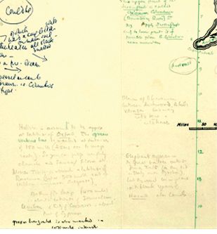
Appendix C: Pauline Baynes’ annotated map
In October 2015, an
LR
map full of hand-written annotations by J.R.R. Tolkien was found in a copy of the books owned by Pauline Baynes. It was evidently the working draught that inspired Baynes’ full-colour map of Middle-earth, published in 1969. This map,
PBM
, notoriously included a number of names that were not found on the map included in
LR
and it had been supposed that these additional terms had been communicated to Baynes by Tolkien. The draught,
PBD
, fully confirms this previous assumption.
Tolkien’s often hard to read notes on
PBD
, published in 2015 by Blackwell, have since been transcribed by Blackwell’s employee Susan Theobald to reveal various intriguing new details which affected the discussions in this book.
First of all, in the lower left corner there is a statement found to the extent that ‘
Hobbiton is assumed to be approx. at latitude of Oxford’. This
is not as new as many commentators have thought. Tolkien simply repeats his statement made in
L
294
that has been quoted in Appendix B. Unfortunately, he failed to add, again, whether Hobbiton was also supposed to be located at the longitude of Oxford, i. e. whether or not it is a geographical, if not historical, precursor of modern Oxford.
More interesting is the continuation of the note: ‘
Minas Tirith is about the latitude of Ravenna (but is 900 miles east of Hobbiton, more near Belgrade)
.’ This more or less confirms the calculations made in Appendix B that have resulted in the maps of
Fig. 25
and
Fig. 26
.
The note continues: ‘
Bottom of the Map (400 miles) is about the latitude of Jerusalem. Umbar & City of the Corsairs - about that of Cyprus.
’ Jerusalem is located at about 32°N and Cyprus at 35°, both values closely match the reconstruction of the map in
Fig. 25
, again confirming our mathematical approach.