Map of a Nation (89 page)
Authors: Rachel Hewitt

Ultima Thule,
1
Union, Anglo-Scottish (1707),
1
,
2
,
3
Union, Anglo-Irish (1800),
1
Unst,
1
Upper Hardes,
1
Upper Nidderdale,
1
Upper Ward of Lanarkshire,
1
,
2
,
3
,
4
Usher, Henry,
1
Wakeman, William,
1
Wales: Ordnance Survey maps and surveys of,
1
,
2
,
3
;
place names,
1
;
specific locations are listed by place-name
Warley Common, Essex,
1
Wast Water,
1
Water Crag,
1
Watson, David,
1
;
joins Army,
1
;
in Flanders,
1
;
proposes survey of Scottish Highlands,
1
;
illness and death,
1
;
last will and testament,
1
Watson, Robert,
1
waywisers,
1
Wedderburn, Alexander,
1
Wellesley, Richard, 1st Marquess,
1
,
2
Wellington, Arthur Wellesley, 1st Duke of,
1
,
2
,
3
Wickham, William,
1
Wilkie, William,
1
William IV,
1
Williams, Edward: appointed deputy director of Ordnance Survey,
1
,
2
,
3
;
life and character,
1
;
‘An Account of the Trigonometrical Survey … 1791, 1792, 1793, and 1794’ (with Mudge and Dalby),
1
;
‘An Account of the Trigonometrical Survey … 1795 and 1796’ (with Mudge and Dalby),
1
,
2
;
death,
1
Williams, John,
1
Wilson, Charles,
1
;
Ordnance Survey of Jerusalem
(with James),
1
Wilson, Sophia,
1
Wiltshire, Ordnance Survey maps and surveys of,
1
Winchelsea,
1
Wingham,
1
Woolwich, Royal Military Academy,
1
,
2
,
3
,
4
,
5
,
6
,
7
,
8
,
9
Wordsworth, Christopher,
1
Wordsworth, John,
1
Wordsworth, Mary,
1
Wordsworth, William: on Salisbury Plain,
1
;
on ‘Engineer agents’,
1
;
suspected of being a spy,
1
;
on City of London,
1
;
on the landscape,
1
;
and William Rowan Hamilton,
1
;
interest in Ordnance Survey of Ireland,
1
;
in Ireland,
1
;
buys Templemore memoir,
1
Wordsworth, William: publications:
The
Excursion
,
1
,
2
;
‘Guilt and Sorrow, or Incidents upon Salisbury Plain’,
1
;
‘Inscription: Written with a Slate Pencil on a Stone, on the Side of the Mountain of Black Combe’,
1
,
2
;
‘View from the Top of Black Combe’,
1
World and Fashionable Advertiser
,
1
Wrotham Hill,
1
Wyld, James,
1
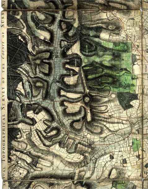
‘Actual Topographical Survey of Sussex’ (with Gardner),
1
Yorkshire, maps and surveys of,
1
Young, Arthur,
1
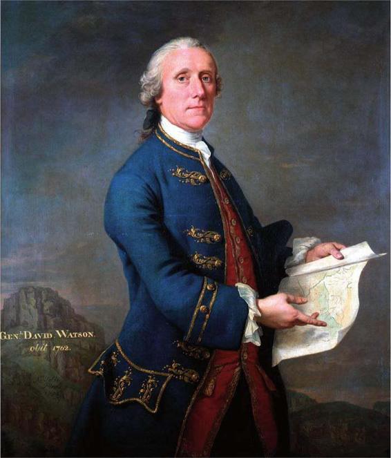
(A) David Watson by Andrea Soldi, finished after Watson’s death in 1762, showing him pointing to his crowning glory: a military survey of Scotland.
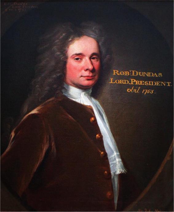
(B) A portrait of Robert Dundas (1685–1753), which hangs in the Oak Room at Arniston House in Midlothian.
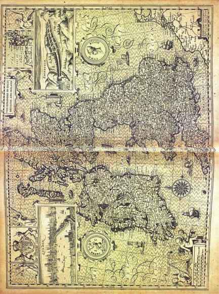
(C) The magnificent map of Britain and Ireland taken from John Speed’s
Theatre of the Kingdome of Great Britaine
, 1611.
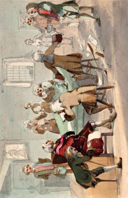
(D)
A Meeting of the Board of Ordnance,
late 1740s, attributed to Paul Sandby.
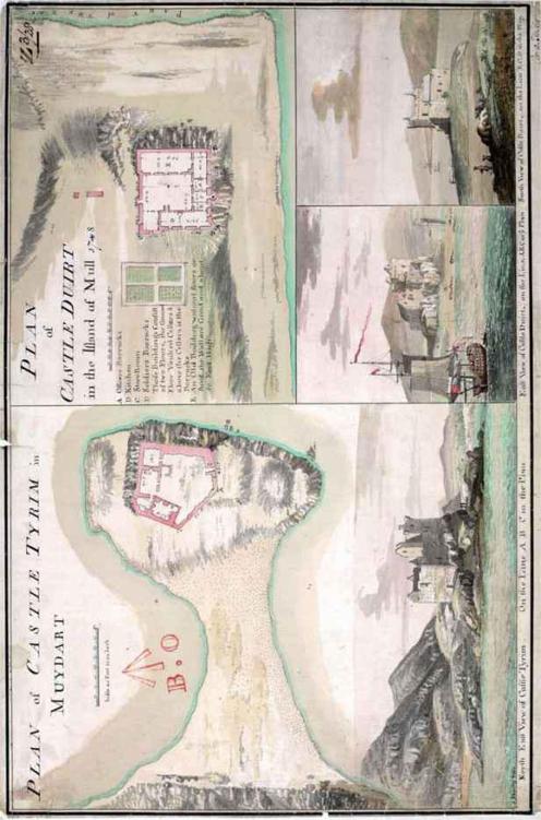
(E) Paul Sandby’s ‘Plan of Castle Tioram in Moidart and Castle Duart on the Island of Mull’. Sandby’s landscapes are peopled with tiny redcoated soldiers.
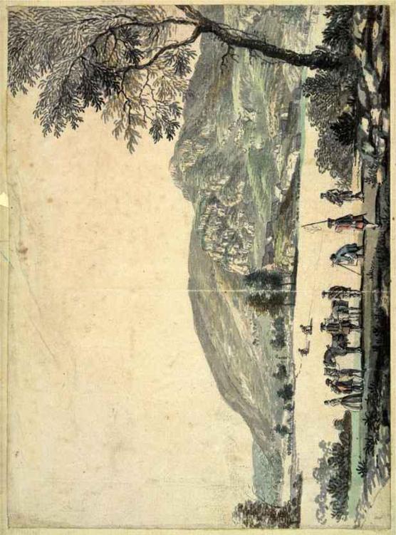
(F) Paul Sandby’s
View Near Loch Rannoch
, 1749, shows a surveying party at work in a field on the north side of the River Tummel, a little south of Drumchastle Wood. The man bent over the theodolite is probably the young William Roy.
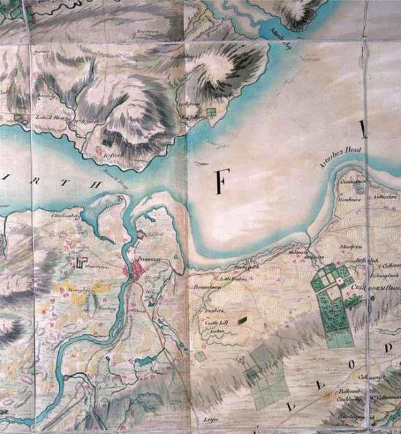
(G) A detail of the area around Inverness and Culloden Moor, taken from the Military Survey of Scotland.
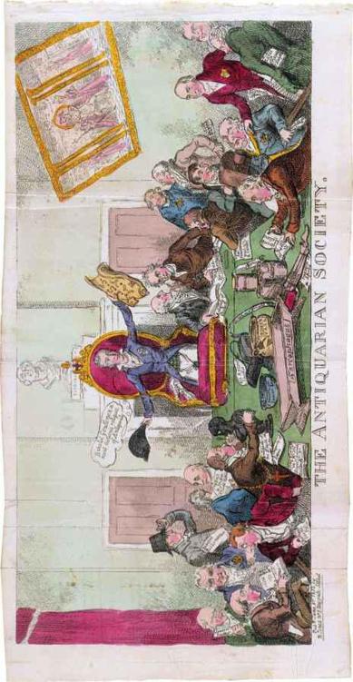
(H) George Cruickshank’s satirical image of the Antiquarian Society from 1812. The figure third from the right, with his pockets stuffed full of papers marked ‘ordnanance affairs’, may be a posthumous image of William Roy.
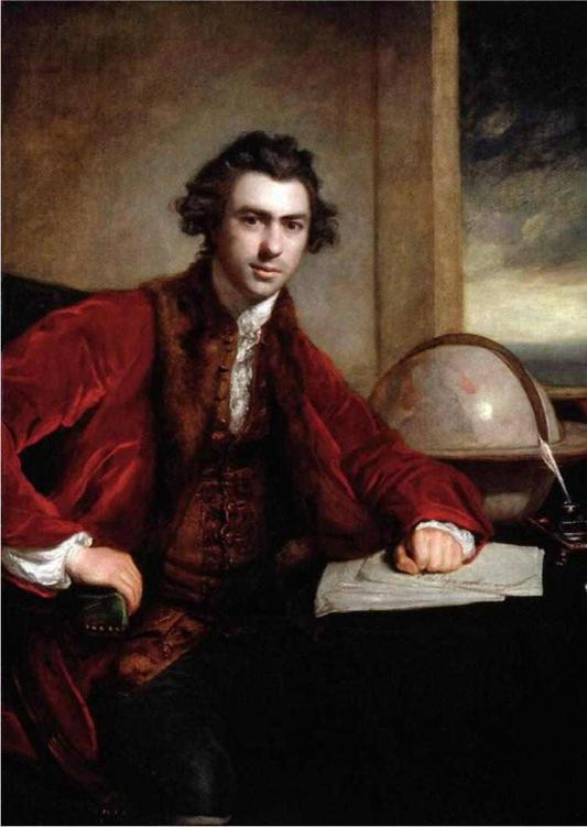
(I) Joshua Reynolds’s portrait of Joseph Banks, 1771–3.
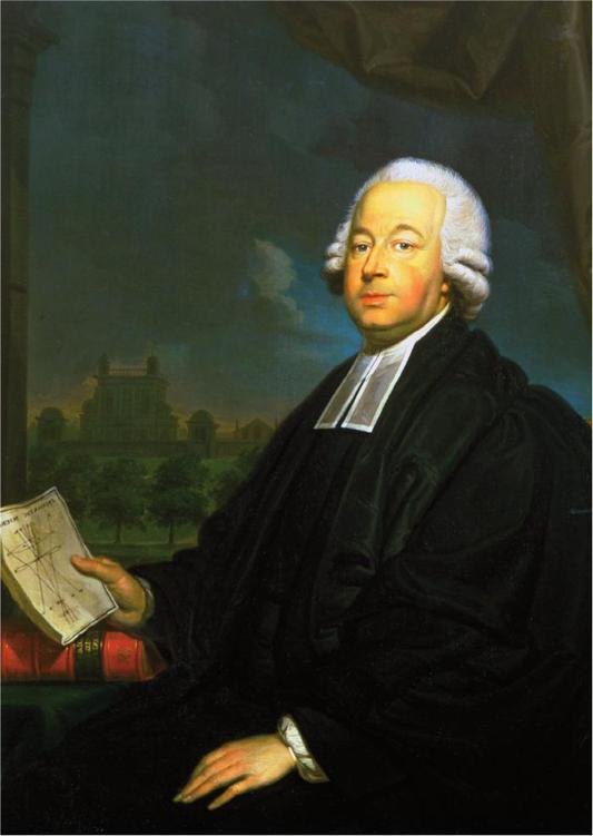
(J) Louis van der Puyl’s portrait of Nevil Maskelyne, 1785.
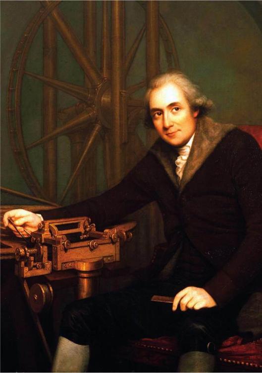
(K) Robert Home’s portrait of Jesse Ramsden, c.1790.
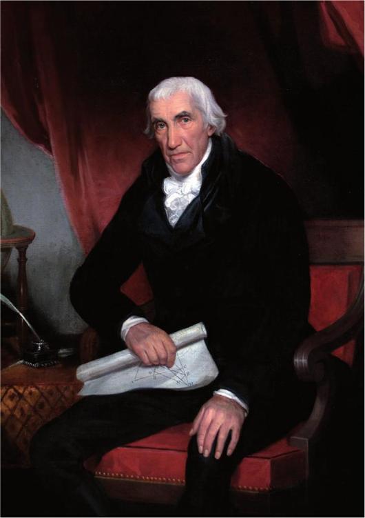
(L) J. J. Hall’s 1816 portrait of Isaac Dalby, the Ordnance Survey’s first assistant.
(M) A detail from Thomas Yeakell and William Gardner’s ‘Great Map of Sussex’, 1778, showing Charles Lennox’s Goodwood estate in green.